
New York, Oct. 12, 2025 (City Desk)
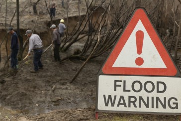
A coastal flood warning, issued by the National Weather Service (NWS), remains active across parts of New York through Monday evening, prompting local officials, transit authorities, and residents to brace for surging tides and possible inundation in vulnerable zones.
What’s Driving the Alert
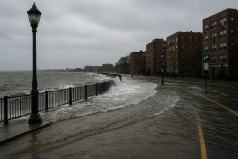
This warning comes as a combination of high tides, onshore winds, and residual storm energy drives water levels higher than usual along New York Harbor, Long Island Sound, and Lower Hudson River shores. The NWS cautions that some areas may see minor to moderate flooding in coastal and low-lying zones, especially during peak tide cycles.
Officials note the region has seen recurring warnings in recent years as rising sea levels and episodic storm surges pose increasing risks—heightening concerns about infrastructure resilience and long-term climate adaptation.
Local Response & On-the-Ground Conditions
City and state emergency agencies have mobilized preparedness operations. Flood-prone neighborhoods such as parts of Staten Island, the Rockaways, and southern Brooklyn remain under particular watch.
At a press briefing, New York City’s Office of Emergency Management (OEM) spokesperson Maria Chen said:
“We’re urging all residents in coastal areas to stay alert, avoid parking near seawalls or shorefront streets, and heed barrier or evacuation orders if they’re issued.”
Transit officials have also stepped into action. The Metropolitan Transportation Authority (MTA) warned of possible service slowdowns or suspensions in subway and light-rail lines that lie beneath vulnerable zones. A spokesperson added:
“Should water begin to encroach in tunnels or low stations, we will enact protective measures, including temporary closures or reroutes.”
Some early signs of flooding have emerged. In the Howard Beach and Far Rockaway areas, residents reported water creeping onto sidewalks and into lower basement levels. One homeowner, Linda Morales, described the situation:
“By late evening, a few inches of water lapped at our walkway. We set up pumps and sandbags, but the surge keeps pushing more in.”
However, no widespread structural damage has been confirmed yet, and no injuries linked to flooding have been reported as of this writing.
What’s Confirmed vs. What’s Expected
Confirmed:
The NWS flood warning remains in place until Monday evening.
Local agencies are actively monitoring tide cycles and deploying response teams.
Some minor street-level flooding and basement seepage reported in coastal communities.
Expected / Alleged:
Flooding severity could escalate during peak high tides or if onshore winds strengthen.
Transit disruptions or property damage may become more widespread if conditions worsen.
Officials may issue evacuation or parking restrictions in severely affected zones, though none have been announced yet.
Next Steps & What to Watch
As Monday progresses, meteorologists expect the most critical periods to coincide with midday and evening high tides. Residents and visitors should:
Monitor local advisories via city or weather authority channels.
Avoid unnecessary travelin coastal zones, especially on waterfront roads.
Be ready for transit changes—check MTA alerts for closures or delays.
Safeguard propertyby moving vehicles off vulnerable streets and securing lower-level entry points.
City agencies plan to continue evaluations into Tuesday morning. Should flooding conditions worsen, officials may escalate warnings, or even mandate limited evacuations.
On the broader scale, these events highlight New York’s ongoing challenge with coastal resilience. As sea levels rise and storm patterns evolve, officials say bolstering flood defenses, updating building codes, and enhancing early-warning systems will be key to safeguarding communities.


Comments
No comments yet. Be the first to comment!